
Test your knowledge of West Hartford history with this ‘Monday Memory,’ courtesy of the Noah Webster House and West Hartford Historical Society.
By Ronni Newton
It’s time to take a look back into West Hartford’s past to either stir up some memories, reflect on how much things have changed, or both. And if you have no idea, we love the photo captions, too!
My apologies that other news interfered with the regularly-scheduled “Throwback Thursday” feature. We’re substituting a “Monday Memory” in its place, and it’s really a bonus for this week because in just a few days there will also be a “Throwback Thursday.”
Courtesy Noah Webster House & West Hartford Historical Society
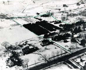
The posted image from Thursday, March 3 (at right and in larger size below) is not of just one building, but rather is an interesting aerial view of an area of West Hartford.
These are the types of photos that always stump me. When I look out the window from an airplane, I am rarely able to properly identify the scenery below.
Rob Rowlson was the first to weigh in: “Wild guess coming your way. This is a really old picture. Foreground is New Park Avenue. Two large building in rear are chandler Evens (now Colt). If correct then the top green line is likely to be Quaker Lane South. Very difficult one this week.”
Liz Gillette had a different idea: “I’m going to wild guess South Main looking west, just north of Rockledge and south of the Noah Webster House. I think the fields in the back will become the golf course. I think at least the two houses on the left hand side are still there. I have no idea what the green line would signify other than some sort of boundary. This IS a tough one!”
And from Mike Margolis: “Liz is right. You can actually see the Noah Webster house on the very right (with a porch on the side!), and then to the left 235 South Main with its five windows in the front, and then 241 (the big brick one that’s all torn apart now). 235 was built in 1937, so the photo is at oldest from then. Behind them is now Pheasant Hill, which was built in the 1960s.”
To which Liz responded: “Thanks, Mike. We’ll see if it is the right guess. But … it was actually my husband, Doug, who looked over my shoulder for a brief glance and said, ‘That’s Rockledge.’ Then I saw it. But don’t tell…”
History buff Rick Liftig added his comments on Facebook, and also agreed that this was a tough one: “Wintertime and the sun is coming from the South. So the road is a North-South Road. I’m guessing this is the area of South Main north of Rockledge and south of the Noah Webster House. The house in the lower left corner is two or three doors to the north of the present day golf course and the Sulgrave or Ridgebrook Circle can be seen on the top right of the photo. As to when this was taken, woooo… tough, tough, tough… I’ll guess the 1930s. The trees are awfully small compared with today! Does the green line denote the Noah Webster property? If so, this could have possibly be taken around 1960 when the town obtained the property.”
“Rick,I think you nailed this one … Well Done! … I just did a google earth check and it does verify your guess. My first thought was that the houses were too far from the road to be on Main St but I was wrong,” added John Maloney.
Beth Ryan, who lives across the street from the Noah Webster House, agreed, as did John Hogan, who grew up in the area.
Trish Nelson, Ned Lessor and Jane Penfield, commenting on Facebook, also thought this was South Main Street, and Jane correctly identified the Noah Webster House in the lower right hand corner of the photo.
“The second building to the right looks like the one being gutted on S Main – near Crestwood and Rumford,” David Dyson [correctly] commented.
“I think … that’s Noah Webster house at far right, second house to the left of that is the large brick Colonial that been under renovation for a while. Property behind the houses is now Rockledge and Pheasant Hill Drive neighborhood,” added Susan Wiley.
I live in this neighborhood as well, which is pretty much the only reason why I was able to identify the area even before I looked at the description I was given.
As for the year, I’m sorry to say we don’t have that information. The homes on Sulgrave were built in the 1930s and 1940s, so if the circular road that is visible is Sulgrave, then Rick’s first guess about this photo being from the 1930s is most likely correct. Most of the homes on Pheasant Hill were built in the 1960s, but Pheasant Hill is directly west of the Noah Webster House, so I think the circle is Sulgrave.
Courtesy Noah Webster House & West Hartford Historical Society
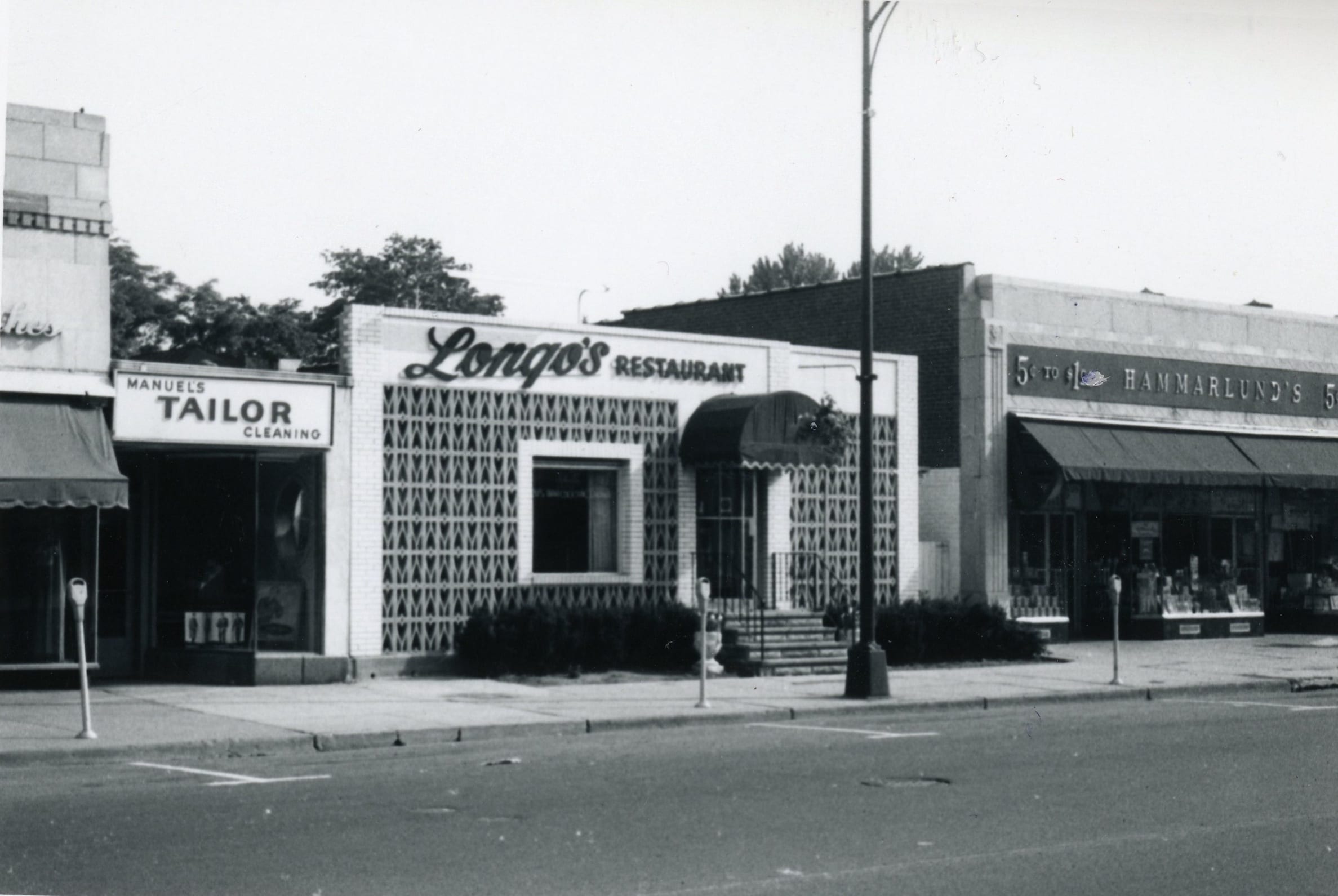
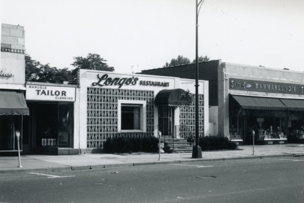
This week’s image (at right and in larger size below) is definitely going to be much easier to identify!
Who knows what is in this space now?
What businesses surround this area?
What are the businesses that have occupied this space?
When was this photo taken?
Does anyone remember going to Longo’s?
Please share your memories below.
Thank you to the Noah Webster House & West Hartford Historical Society for providing us with the images. They are always looking for new images to add to the collection. Visit their website atwww.noahwebsterhouse.orgfor more information about membership and programs.
Like what you see here? Click here to subscribe to We-Ha’s newsletter so you’ll always be in the know about what’s happening in West Hartford!
Courtesy Noah Webster House & West Hartford Historical Society
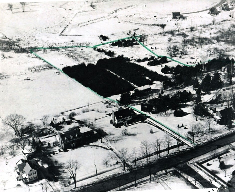
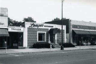
South Main Street. Noah Webster House is at far right. Courtesy Noah Webster House & West Hartford Historical Society


Easy one for anybody who grew up in West Hartford! Hammarlund’s was one of the only places in town where a kid could walk in with a quarter and come out with something cool. The restaurant has seen various incarnations…
Our family originally lived on Whiting Lane,and later moved to Kingston Street. Then in 1935 we moved from West Hartford to Philadelphia because the SKF Bearing Co. plant was closing. My dad was a machinist there and was offered a job in Philly. I was 10 years old and had attended the Seymore Ave. Grammar School. I remember one teacher’s name, a Ms Dube. My sister Ruth and I used to swim at the Fern Street Pool and usually were driven there in the rumble seat of one of our neighbors sports coupe. I remember the extensive sewer work on Park Ave and used to watch the workmen drinking water from a bucket with A large ladle. The library and museum were popular haunts for both of us, especially the movies every Saturday showing the history in the time of the revolutionary war and after.
Hammarlunds is now the CVS drug store – Longo’s is now the Treva resturant.