
Discover West Hartford Series: Historic Site Loops

Audio By Carbonatix

41 historic West Hartford sites are listed on a sign in front of the Noah Webster Library. Photo courtesy of Jeff Shaw
West Hartford resident Jeff Shaw’s latest adventure was an attempt to visit all 41 of the town’s most historic sites.
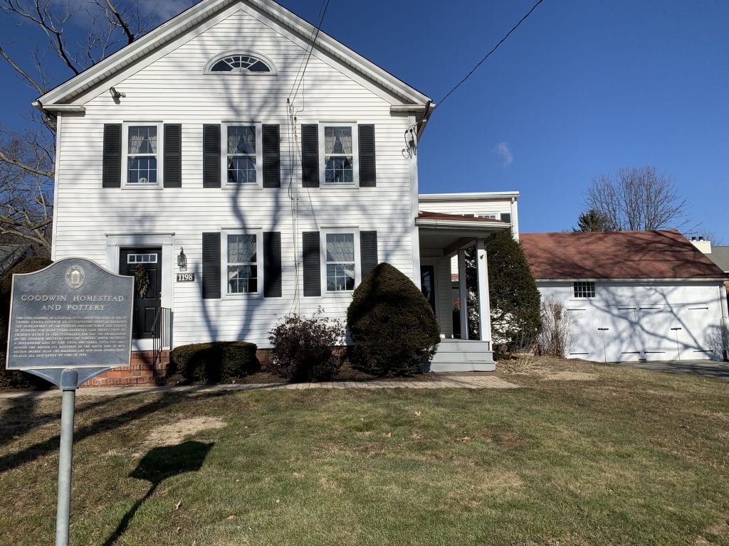
Goodwin Homestead and Pottery in Elmwood. Photo courtesy of Jeff Shaw
By Jeff Shaw
Hidden in plain sight is a four-square foot, blue, weather-worn cast aluminum sign in front of the Noah Webster Library. The sign (and map) lists 41 of the most significant historical places, people and events most relevant to West Hartford’s history.
In another attempt to Discover West Hartford (by bike or foot; by ski or sled), I set the goal of visiting all 41 most historic sites, many of which blend into the scenery of our neighborhoods. While not a historian, I do appreciate authentic places. Knowing, understanding and appreciating the past is informative, certainly necessary for preservation, and generally helps avoid repeating mistakes.
Local history is also interesting. I mean, what other town can you name that once had a racetrack, ski area, and dairy farm? Why, West Hartford of course!
If you are up for a local historical adventure, the following information provides some tips. I’ve created “loops” based on the concentration of historic sites in certain parts of town. The idea is that each loop can be covered at a leisurely pace within an afternoon.
Not all historic sites are mentioned below; though I am happy to share the complete list by request. Better yet, reference the four-square foot cast aluminum list and map to create your own loop or photo scavenger hunt!
But first, a bit about signage. Many of West Hartford’s most historic sites are marked with official commemorative signs or plaques that range in size and location. Some historic sites have homemade signs. Others have no signs and are literally hidden in plain sight.
A few historic sites have been completely lost to time or development. Finally, visit the Noah Webster House & West Hartford Historical Society and/or the Noah Webster Library for more detailed information on any of these or other historic sites and places.
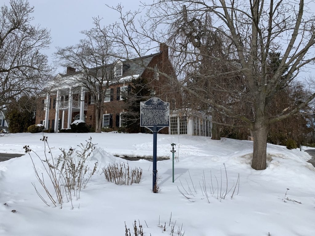
West Hill Drive Historic District. Photo courtesy of Jeff Shaw
Buena Vista to Mountain Road Loop
As the name suggests, this loop covers the Buena Vista neighborhood, the West Hartford Reservoir, and our local highway (Mountain Road – please slow down – thanks!). Most recognizable is likely the Old West School on the corner of Mountain Road and Buena Vista. The former school and surrounding homes are part of a designated historic district which extends up Buena Vista Road and into side streets.
As for what has been lost over time, I nearly fell off my chair when first learning Buena Vista Golf Course was once a ski area. Additionally, the remains of a Revolutionary War Campsite (stone-lined fireplaces) can be found with a short walk off the paved loop of MDC Reservoir #6. You will need to bushwhack until you get to the site, so beware of ticks and muddy patches.
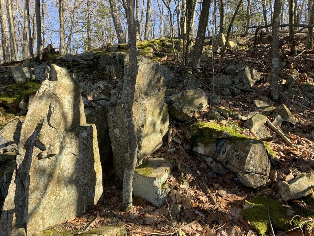
Stone-lined fireplaces. Photo courtesy of Jeff Shaw
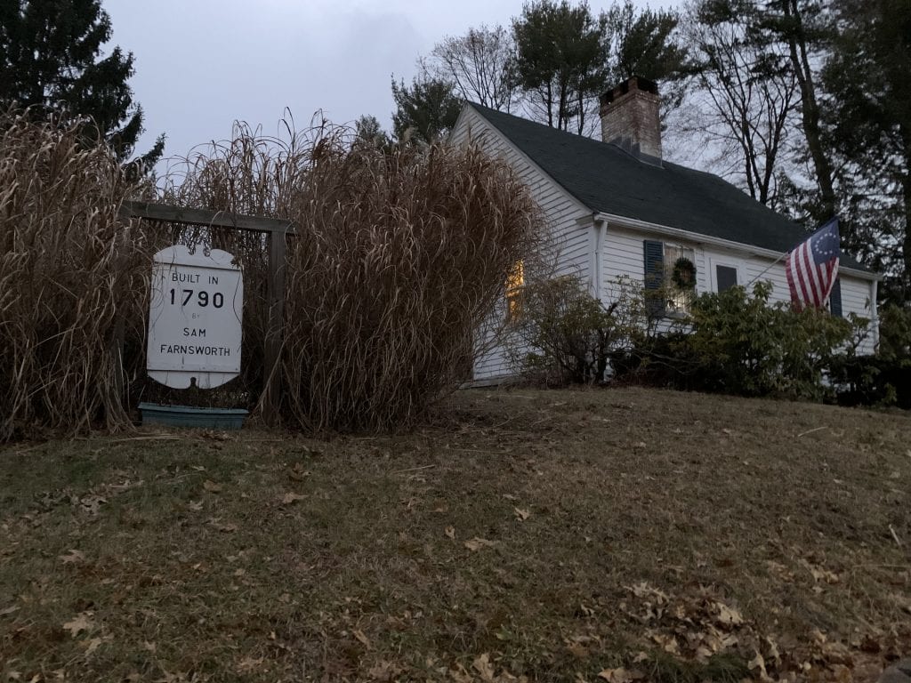
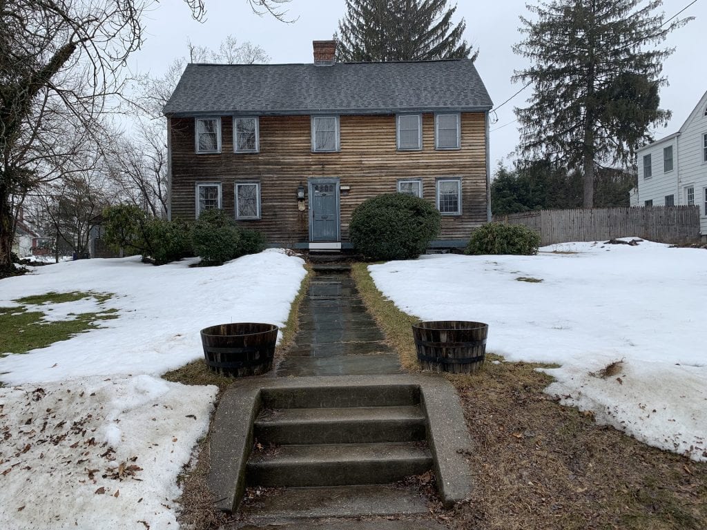
Samuel Farmsworth House, off Mountain Road. Photo courtesy of Jeff Shaw
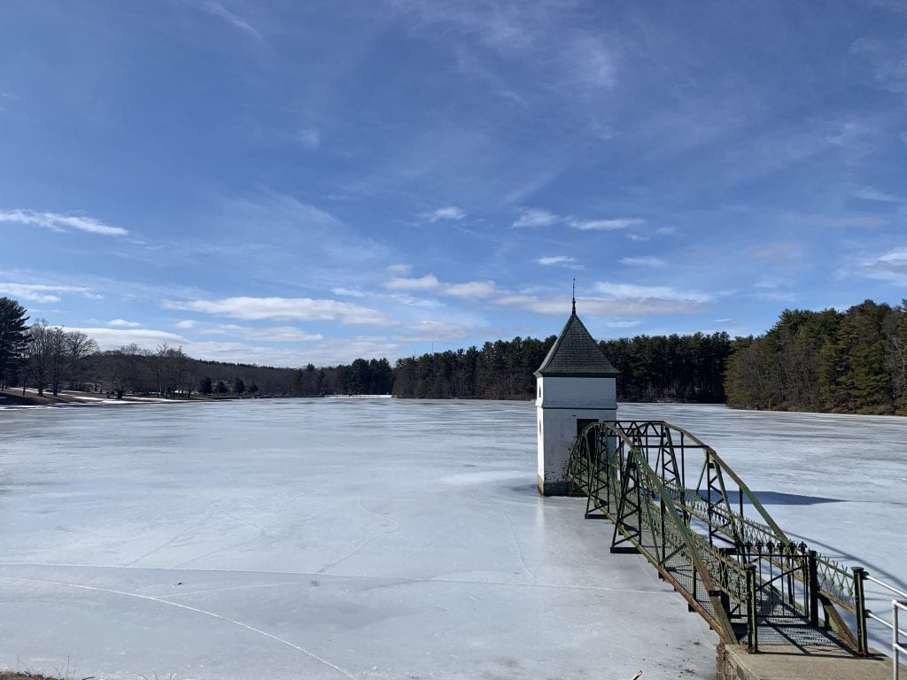
MDC Reservoir No. 1. Photo courtesy of Jeff Shaw
Center to Bishop’s Corner Loop
This loop covers the main drag for life in West Hartford as it was in the 17th century through the present day. Follow North Main Street from Unity Green (formerly Goodwin Green) all the way to Bishop’s Corner. These sites are mostly historic homes and buildings. The charming design of front porches, center or double chimneys and old cement steps from the road are clues.
Most recognizable are probably the Old Center and Old North Cemeteries, the former being a home to recently installed stones of the Witness Stone Project. The latter is also the location of the festive West Hartford Hauntings presented by the Noah Webster House and West Hartford Historical Society.
As for what has been lost, the Old Grist Mill site, adjacent to Wyndwood Road and the nearby pond, was home to yarn and corn mills in the 1700s and 1800s. Additionally, former Trout Brook Ice and Feed, an important ice cutting and shipping industry in the late 1800s and early 1900s, was located at the corner of Trout Brook and Farmington Avenue.
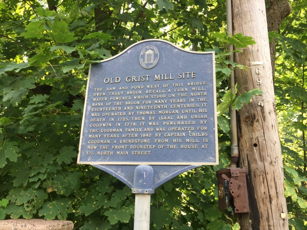
A marker for the Old Grist Mill site is located at 175 North Main St. Photo credit: Ronni Newton
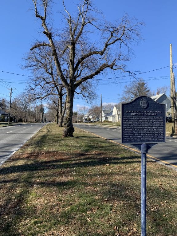
Marker for the former trolley line and Raymond Road Historic District. Photo courtesy of Jeff Shaw
Elmwood & Albany Avenue Loop
While Elmwood and Albany Avenue are not near each other, they are connected by none other than North (and South) Main Street. In the Albany Avenue section, the secluded mansions of the West Hill Drive neighborhood are unknown to many passing on Farmington Avenue. In the Elmwood section, the stretch of New Britain Avenue from South Main Street to Elmwood Center includes the Beach House, former Vine Hill Dairy Farm, Sarah Whitman Hooker House, and Goodwin Pottery.
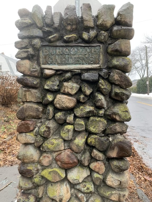
Burgoyne Gardens, Elmwood. Photo courtesy of Jeff Shaw
This stretch of Elmwood is also home to former Burgoyne Gardens, one of the oldest historic sites in West Hartford. As for what has been lost, the Charter Oak Racetrack and Luna Park used to exist on the tract of land between Flatbush Avenue, Park Road, Talcott, and Quaker Lane South.
While spending time pondering the “what ifs,” is usually not productive, imagine for a moment a present day West Hartford with its own racetrack, ski area, and dairy farm. Now that would be some way to discover West Hartford!
Please note many of these sites are located on private property, so please respect the neighbors.
Timothy Goodwin House on South Quaker Lane. Photo courtesy of Jeff Shaw
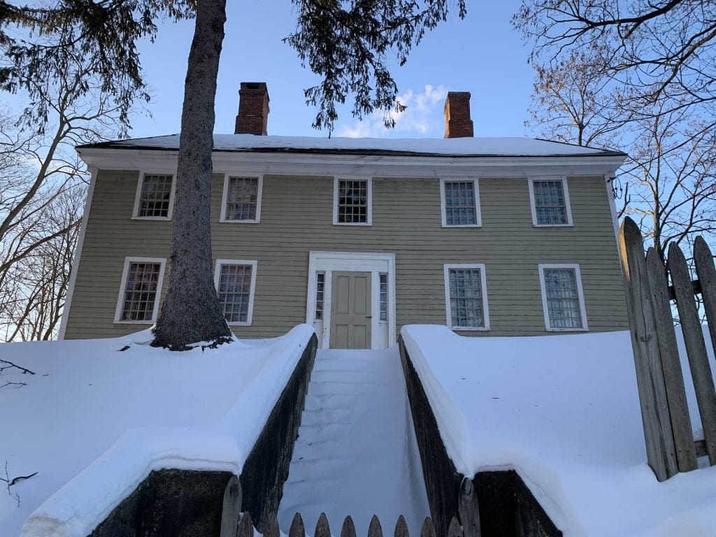
Sarah Whitman Hooker House. Photo courtesy of Jeff Shaw


What is the significance of the two rock pillars marked with plaques “Burgoyne gardens”? I live in a hidden enclave off of Burgoyne street. Joan long