From the West Hartford Archives: Buena Vista, Looking East from Current Cornerstone

Audio By Carbonatix
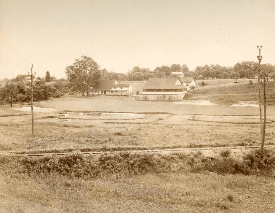
Buena Vista, looking east from current site of Cornerstone. Photo courtesy of Noah Webster House & West Hartford Historical Society
Historian Jeff Murray takes a look into West Hartford’s past to uncover some surprising information, stir up some memories, or reflect on how much life has changed – or hasn’t changed at all. Enjoy this week’s ‘From West Hartford’s Archives’ …
By Jeff Murray
This is a view of Buena Vista from the current site of the Cornerstone Aquatics Center, looking east.
The history of this area can be started with Buena Vista Road, which runs along the tree line to the left. Originally known as the South Middle Road, this ancient avenue followed Park Street through Hartford, Park Road, and Sedgwick Road in West Hartford, and along this track over Selden’s Hill to Farmington.
It was one of the three original roads in town by the early 1700s, the other two being New Britain Avenue and Albany Avenue. In 1800, Farmington Avenue was laid out through the Center, connecting with this road at Gin Still Hill. Still later, after a petition by people in Farmington for a more direct route to Hartford without having to go over the mountain, Tunxis Road was opened in 1839.
Many different families settled in this area, including the Sedgwicks along Sedgwick Road and the Stanleys at Buena Vista. The house in the center-left of the photo is the Stanley-Woodruff-Allen House, originally built in the 1750s by Samuel Stanley.
By the 1790s, Joseph Selden came from East Haddam and moved to the top of the hill, owning all the land on the hill. The area was originally part of the town of Farmington, but when West Hartford was granted independence from Hartford in 1854, Joseph Selden’s son Hezekiah and others petitioned to be included; the General Assembly agreed and Selden’s Hill broke off from Farmington and joined West Hartford.
A map in 1869 shows the families living in the area 15 years after independence – the Selden’s dairy farm on the hill at 111 Buena Vista Road and the Stanleys along Buena Vista Road and on the north side of Selden’s Hill towards Farmington Ave. The area was supplied by the West School, now the West Hartford Art League, at the corner of Mountain Road.
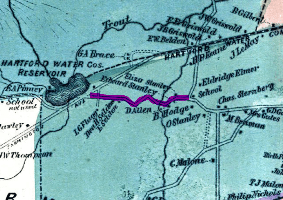
1869 Atlas of West Hartford
Growing population along Farmington Avenue and improvements in technology led in 1894 to the laying of the electric trolley through to Unionville, passing Selden’s Hill. Trolley workmen boarded at the Stanley-Woodruff-Allen house. This prompted real estate syndicates to capitalize on the better transportation to subdivide land for houses away from the city.
In 1895, a company bought up 100 acres of land on top of Selden’s Hill and laid out hundreds of lots along new streets, like Geneva Ave, Wettleson Ave, Everett Ave, and Gin Still Lane. Most of the lots were bought for real estate investment, but others built cottages either along Farmington Avenue across from the Reservoir or at the top of the hill looking out towards Hartford. The first house in this suburban development was built in 1896 at 1359 Farmington Ave. Another notable house was that of Benjamin Des Jardins on the hill looking out towards Hartford in the early 1900s. The family entertained many children every Halloween on the hill.
Ned Wardwell, namesake of Wardwell Road, also owned a house on top of the hill. Hezekiah Selden’s grandson Henry Hezekiah Selden (1854-1932) owned the Selden farm along the south side of Buena Vista Road. This included the current Howland Road, Selden Hill Drive, Brookmoor Road.
One of the biggest changes to the landscape came in 1912. Before that, the area where Cornerstone and the Buena Vista lake and golf course are now were the two farms of Andrew Hansen, a farmer from Denmark who had bought the land from the heirs of Dudley Allen, and Frederick E. Stanley, who owned the land all the way back to Tunxis Road. The Trout Brook Ice Company, which conducted a large operation on Farmington Avenue at Trout Brook near the Center, was expanding their business at the same time. Under Frederick W. Arnold, they practically controlled the entire ice output in the city of Hartford. and bought 125 acres from Stanley and Hansen. With that land, they created a reservoir off Tunxis Road, which is now Woodridge Lake. They built a giant storage house along what is now Waterside Lane.
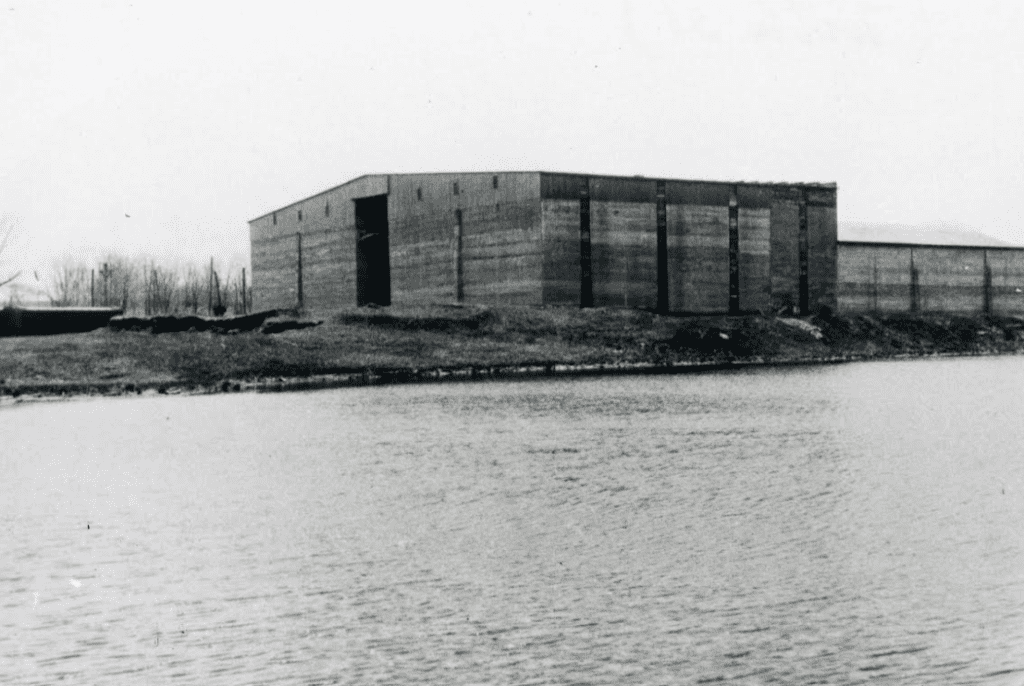
Ice storage house on the northeast side of Woodridge Lake where Waterside Lane is today. Courtesy of Noah Webster House & West Hartford Historical Society
In order to transport ice from Woodridge Lake back to the main hub in the Center, the company built railroad tracks through Buena Vista. From the lake, it tracked through what is now Mallard View Drive, the lot lines behind Briarwood Road, through the parking lot of Cornerstone, and along Common Drive, the lane next to Veterans Memorial rink, until Farmington Avenue, where it connected with the trolley tracks. These freight tracks used to transport ice can be seen in the foreground of the photo below.

Buena Vista, looking east from current site of Cornerstone. Photo courtesy of Noah Webster House & West Hartford Historical Society
In 1927, with the advent of new refrigerating innovations, the ice industry declined and the Trout Brook Ice Company was sold to the Southern New England Ice Company through a merger of the major ice companies in Connecticut. In the late 1930s, the ice company discontinued operations at Woodridge Lake and the freight tracks were disassembled. The land was then sold to Wallace B. Goodwin, a real estate developer from Elmwood, who laid out wooded house lots around Wood Pond and Ridgewood Road into the 1940s.
In 1926, a pay-as-you-go 9-hole golf course along the south side of Buena Vista Road was opened by Joseph Rosenberg, who had built it in the summer of 1925 on the former Andrew Hansen farm. For a period of about a decade then, there was a golf course running along the freight tracks of the ice company, as seen in this photo. It was soon bought out by a private club, the West Hartford Country Club, and operated as the West Hartford Golf Club on the site of the current Buena Vista golf course. In 1943, the Town of West Hartford bought the 70-acre property for a public park. The Buena Vista area became very popular for many winter sports, like skiing and skating.
In 1957, the Cornerstone Club, which was started by a group of residents promoting youth recreation since 1949, paid the town for the construction of a recreational facility for swimming and an ice skating rink. The club had worked for years to build somewhere in town, but suddenly a lengthy legal battle over zoning and protests by some Buena Vista residents ensued, reaching the state Supreme Court through 1960. The issue was finally settled that spring and Cornerstone was opened in 1962. The Hartford Courant reported poetically: “The teenagers of 1949 who started the fund drive for the facility are now grown men and women.”
From Cornerstone to Bridlepath School in 1959 to the new Veterans Memorial Skating Rink that opened in 1968, that decade effectively molded the landscape into what Buena Vista looks like today. The West Hartford Art League, which had used the old (closed) West School as a meeting space, leased the Stanley-Woodruff-Allen House in 1976 from the town, which had bought it as part of the Buena Vista acquisition.
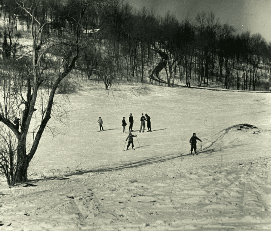
Skiing at Buena Vista. Courtesy of Noah Webster House & West Hartford Historical Society
The Buena Vista area is a great example of the patchwork of unique development West Hartford saw. The Stanley farmland was sold off for the first major suburban development in town in the 1890s; the land was used for the ice industry, which started the neighborhood around Wood Pond; the dairy farm along Buena Vista Road was converted into a golf course; the Selden farm was subdivided into a new wave of suburban development in the 1950s; and the remaining land was used for a horse riding country club, a school, an ice skating rink, and a town swimming pool. Some of these changes took decades; others took just weeks. Local history is important not just to relay what happened on the land before us, but to help us appreciate how much work went into making the area what it is today.
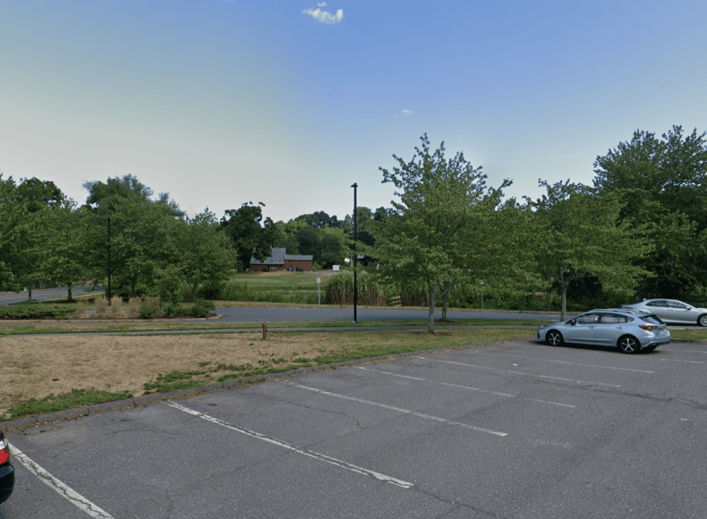
Approximately the same view in 2022. Google Street View
Jeff Murray was born and raised in West Hartford and has been involved with the Noah Webster House & West Hartford Historical Society since 2011 when he was a high school student and won the Meyer Prize for his essay on local history. Jeff routinely volunteers as local history researcher uncovering information for numerous museum programs such as the West Hartford House Tour and West Hartford Hauntings. Jeff works as a data analyst at Pratt & Whitney.
Like what you see here? Click here to subscribe to We-Ha’s newsletter so you’ll always be in the know about what’s happening in West Hartford! Click the blue button below to become a supporter of We-Ha.com and our efforts to continue producing quality journalism.


Wow Jeff – I never knew that Buena Vista’s origins were so ancient. I had seen some very early maps showing the path from Farmington and naturally assumed they followed Tunxis Rd. I wonder if BV was the high road that remained passable even when the low road was full of mud? A similar pair is Talcott Notch Road and Old Mountain Road in Farmington. And of course, NBA (rt 6) is pretty old too.
What wonderful research! So many details and changes to reflect on. I am always so astonished to see the vistas across what was almost treeless farmland. The hills and valleys are so much more apparent. We really are very detached from our topography today. Years gone by ‘function’ was very much tied to ‘form’. Thank you for your work.
P.S. Hi Rick, not surprised to see you here in the comments!