
West Hartford’s ‘Thursday Throwback’

Audio By Carbonatix

Courtesy Noah Webster House & West Hartford Historical Society
Test your knowledge of West Hartford history with this ‘Thursday Throwback,’ courtesy of the Noah Webster House and West Hartford Historical Society.
By Ronni Newton
It’s time to take a look back into West Hartford’s past to either stir up some memories, reflect on how much things have changed, or both. And if you have no idea, we love the photo captions, too!
Courtesy Noah Webster House & West Hartford Historical Society
The photo from two weeks ago (sorry …) was a tough one, and there were lots of disparate guesses.
“I believe the West Hartford Art League now occupies the building, on Buena Vista Road.When I was in high school in the early sixties I worked part time for the Parks and Recreation Department. The superintendent for the golf course lived in the house at the time,” commented Derek Pariseault.
“One more possibility could be part of the Beach farm property. That I don’t remember it’s just a guess and I don’t think there’s anyone alive today who would remember the location,” Derek added.
Many of the guesses were on Facebook.
“Mountain road near spice bush swamp?” commented Tammy Brewer Kroll. Patrice Fitzgerald agreed.
A few others guessed Mountain Road, and there were also some votes for South Main Street near the Noah Webster House, the blacksmith shop on Albany Avenue, Sunset Farm, Old Meadow Road off Farmington, stables behind the skating rink, and Old Mill Lane.
“South Quaker heading south toward New Britain Ave. I think that building is the old dairy,” commented Susan Wiley.
Jeff Murray, a local history buff, had some very specific information: “This photo was taken June 7, 1926 by a police officer.” Jeff has seen a higher resolution copy of this photo, and knew exactly where it was.
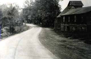
Susan, and all of the others who guessed South Quaker Lane, are correct. The photograph was labeled “Road to Vine Hill Creamery,” and the creamery was part of the Vine Hill Dairy, on the land that was owned by the Beach family and is Beachland Park today. The view is looking south, toward New Britain Avenue. Thank you to Jeff for confirming the exact location!

Courtesy Noah Webster House & West Hartford Historical Society
I thought that this week’s photo (at right and in larger size below as well as at the top of this column) was a fun one for the day before the unofficial start of summer.
Who knows where this is?
When was this photo taken?
What is in this location now?
If you have memories, please share them below.
Thank you to the Noah Webster House & West Hartford Historical Society for providing us with the images. They are always looking for new images to add to the collection. Visit their website at www.noahwebsterhouse.org for more information about membership and programs.
Like what you see here? Click here to subscribe to We-Ha’s newsletter so you’ll always be in the know about what’s happening in West Hartford!
Courtesy Noah Webster House & West Hartford Historical Society
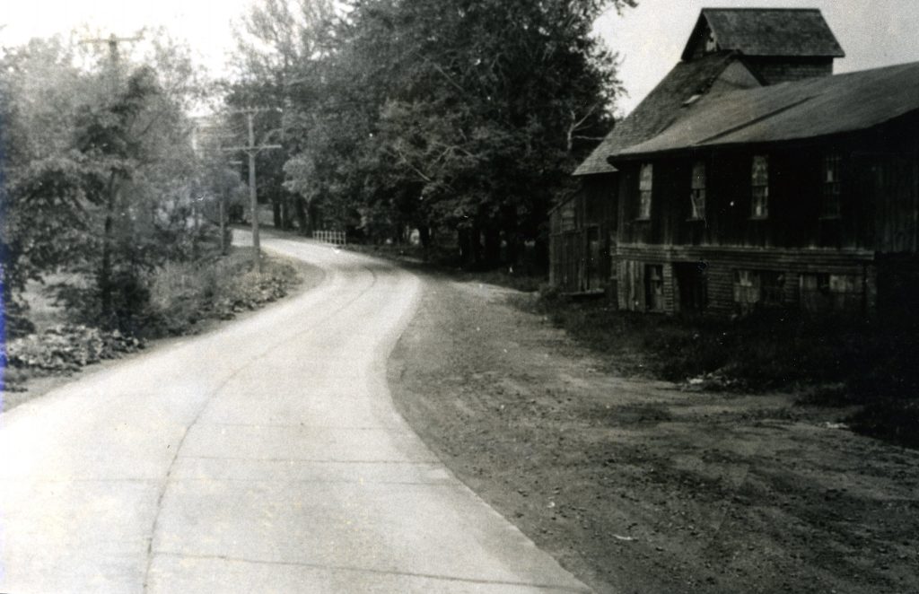
Road to Vine Hill Creamery (South Quaker Lane). Courtesy Noah Webster House & West Hartford Historical Society


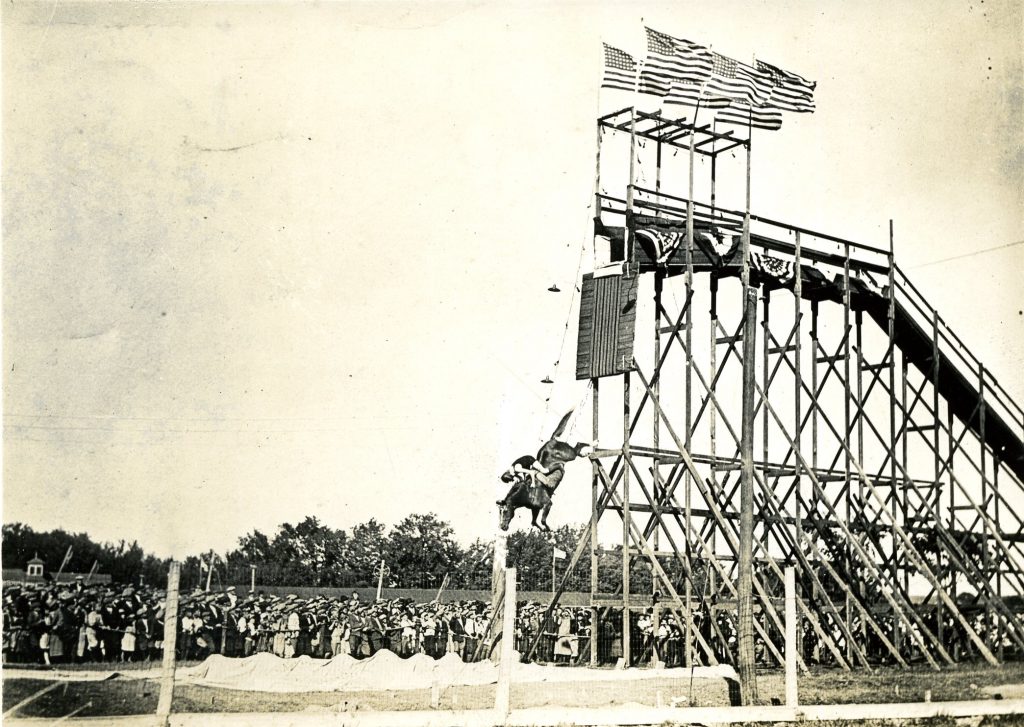
Wow Ronni – that’s a crazy picture! Today, there would be demonstrations by animal rights groups and it would be posted live on Instagram. I’ll guess that this is at Charter Oak Racetrack. There are 48 stars on the US flag (1912-59); the track was closed in the mid-1930’s; the rider is wearing a full bathing suit which would have been the style in the teens and twenties; the men and women in the photo are all wearing hats; the women have billowy dresses. Datewise, I would guess early 1920’s. Thanks for the interesting photo!
I believe this was on the property where the Charter Oak Park once was. It was also at one time also for the Connecticut State Fair and a portion of the property was also developed into Luna Park. The property was bordered by Flatbush Ave. on the north, South Quaker Lane on the west and Oakwood Ave on the east . The sequences of it use I haven’t a clue but my best guess on the photo would be sometime in 1920’s. at present i think the fields are used for youth soccer.